Sectorisation, Zones & Worksite
Sectorisation
A disaster that warrants international USAR response is inherently a large-scale event. The scale of destruction may just involve one city, or it may affect a large area involving numerous cities and even more than one country. Geographical sectorisation of the affected areas can be needed to ensure effective coordination of SAR efforts by improving the span of control. Sectorisation will improve operational planning, more effective assignment of the USAR teams and better overall management of the incident. The size and numbers of the sectors will depend on the level of resources and the needs of the affected area, the volume of work, geographical area and features, scale of response amongst other factors.
Sectorisation Plan
Sectorisation should be undertaken at the earliest possible stage of a disaster response to ensure its effectiveness. It is expected that the LEMA should have a sectorisation plan in place and that international USAR teams should follow it. The LEMA is likely to refer to local sectors such as neighbourhoods, parishes, etc. as the local government will have information organised in this format.
However, if there is no sector plan, it should be developed at the earliest possible stage of a disaster response and in close liaison with the LEMA. This may be done by the UNDAC team but will often be done by the OSOCC or UCC personnel from the USAR teams. If the LEMA has no sector plan, then a wide area assessment (ASR1) may be necessary to get the relevant information to design the sector plan.
During sectorisation, local geographical and transport challenges should be considered so as to facilitate the most efficient deployment of resources in the shortest amount of time.
Sector Identification
The default INSARAG sector identification system is to use a simple lettering system to code each sector: A, B, C, D and so on. Do not to use the letter I and O to avoid any misunderstandings with the numbers 1 and 0. A local name or description can also be added to ensure clarity e.g. Sector A, North Padang. If the LEMA has its own a coded sector identification system in place (e.g. Sector 1, 2, 3, or Red, Blue, Green etc.), it should be adopted and allow for it in any documentation or markings.
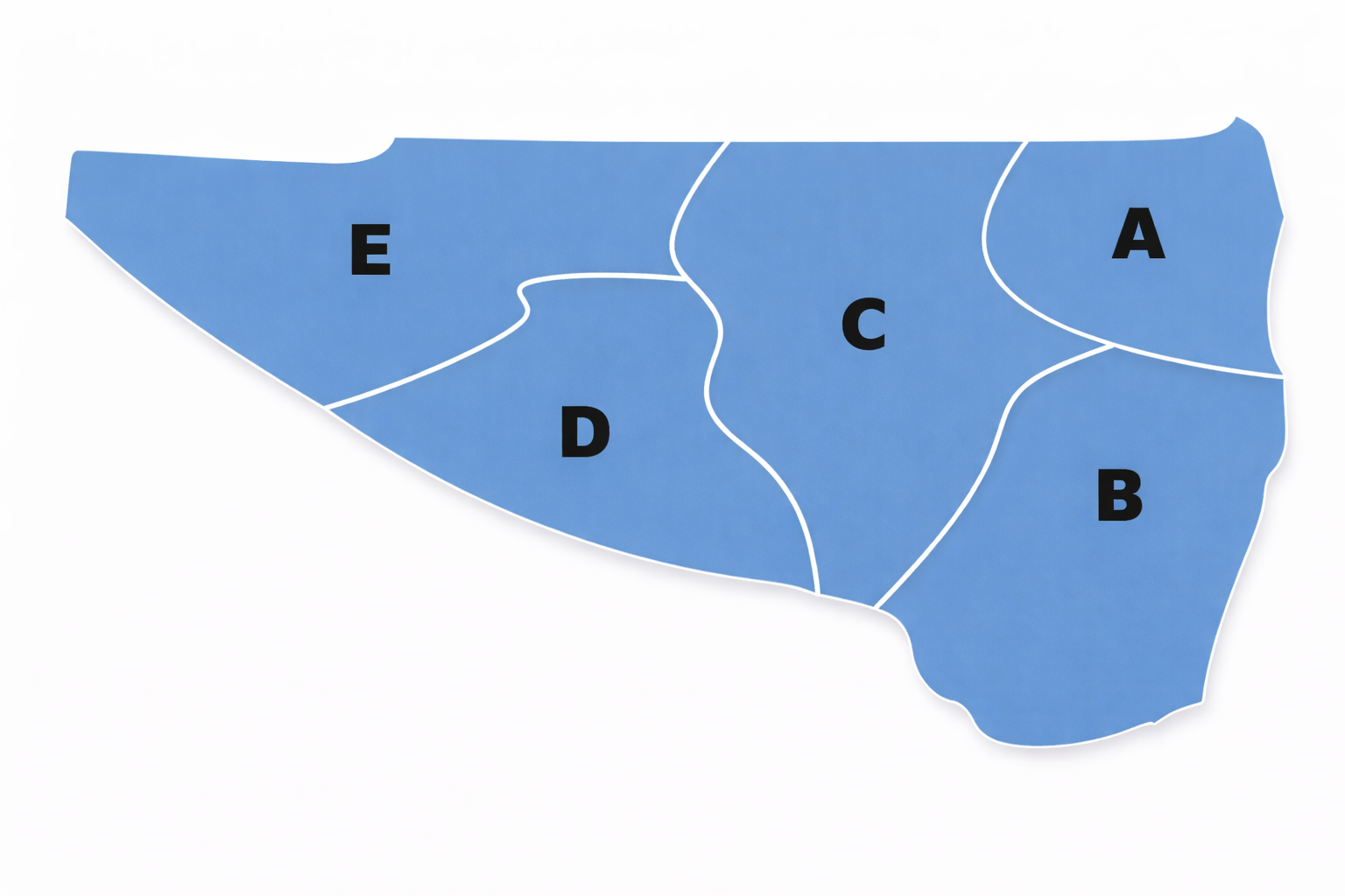
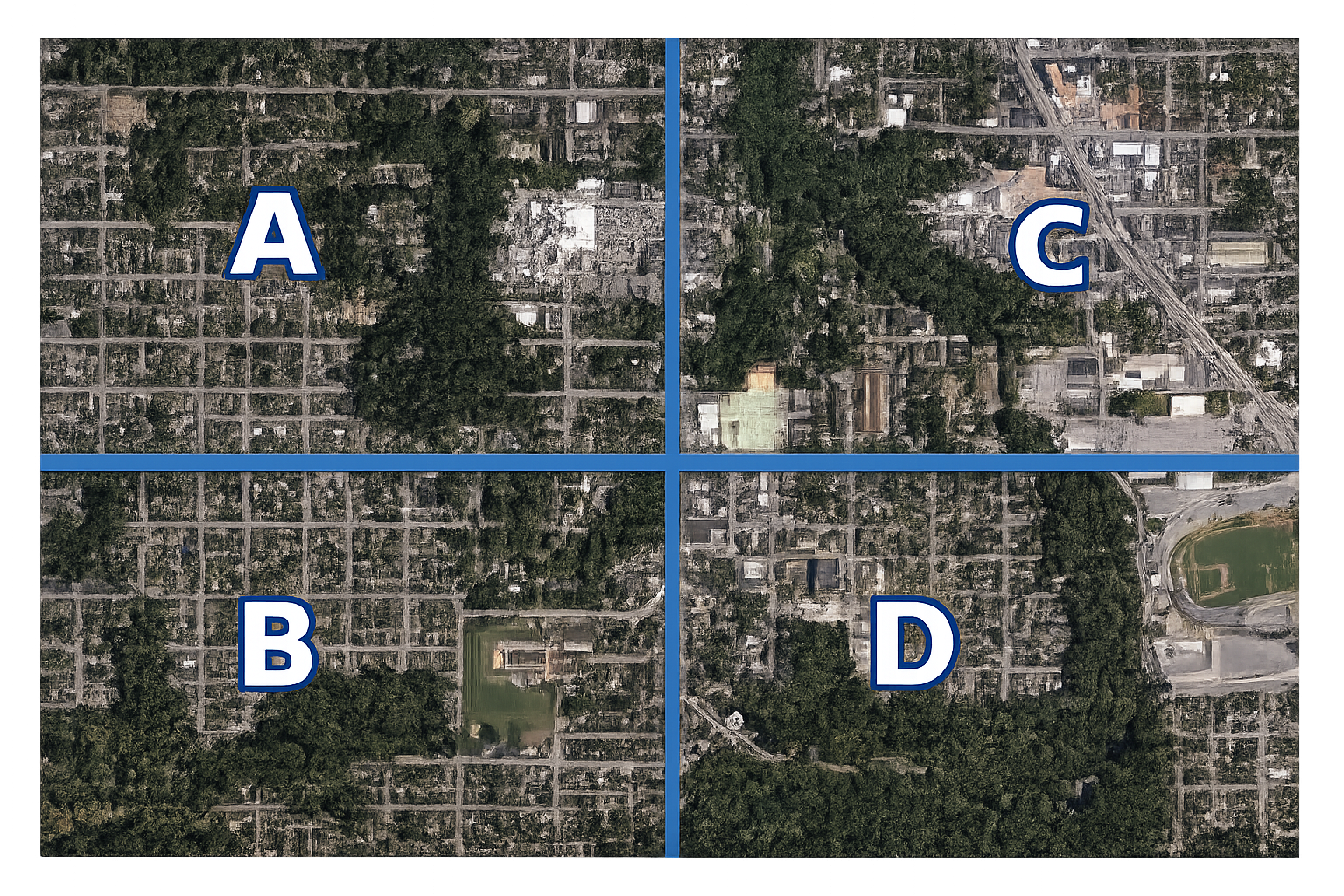
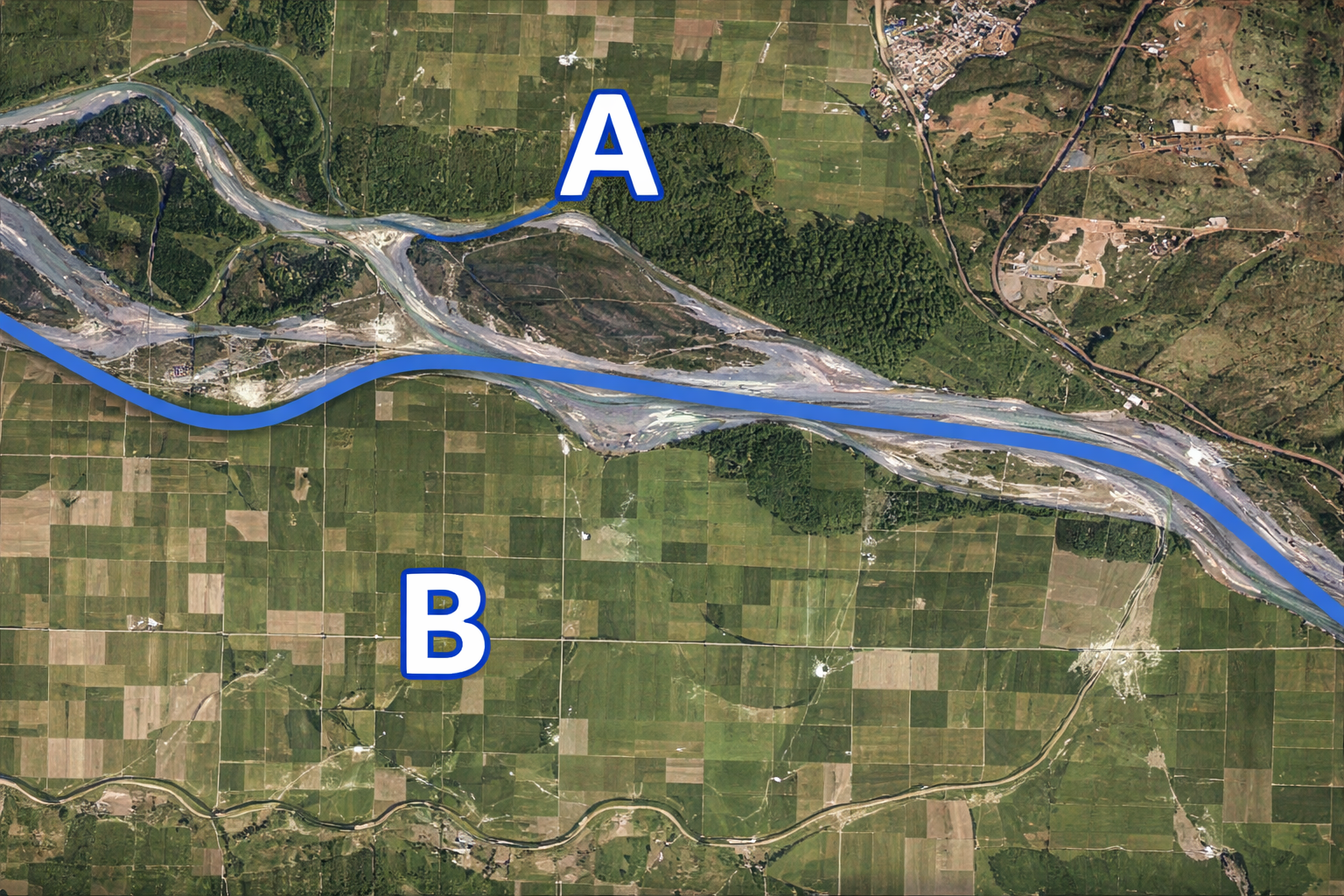
The diagrams below are simple illustrations of how geographical sectorisation can be done.
Sectorising the affected areas into smaller manageable sectors:
Sectorising an affected area using streets and city block layouts:
Sectorising an affected area using prominent features e.g. Sector A North of the river, Sector B South of the river:
Zones
Within sectors, zones can be established. A zone is a geographical area (within a sector) attributed to 1 single USAR team in which that team has the responsibility to identify worksites, prioritise them and perform USAR operations. Zones are relevant if, during the ASR2 of the sector, the number of possible worksites is strongly exceeding the operational capacities available. Normally this means the operational tactics will switch to rapid response mode.
The zone identification does not match the sector it is in. It is made up of the USAR team identification code, a dash "-”, a single digit followed by the letter “Z”, e.g., USA01-1Z. Zone identifications are only used on forms and in ICMS. No such thing as a zone marking exists.
Worksite
To allow effective coordination it is essential to uniquely identify every site where significant USAR operations take place. Each of these sites will be known as a worksite.
A worksite can mean different things, but the simplest definition is “Any site where significant USAR operations are carried out.” USAR operations normally only take place when there is thought to be the potential for a live rescue. However, to avoid assigning teams to sites that only have victims to be confirmed dead, these sites may be given an identification (ID) for documentation purposes. Worksites will typically be one building where one USAR team or squad is working because of a potential live rescue. But a worksite could be much larger or much smaller. A large building or complex of buildings, e.g. a hospital, may be identified as a single worksite. Alternatively, the site of a single rescue in an area of only a few square metres would also be identified as a worksite.
Refer to INSARAG Marking and Signalling for Worksite Markings.
Worksite Identification
When it is decided that a site will need USAR operations, usually rescue work, it should be given its own Worksite Identification (Worksite ID), the Worksite ID is in addition to the existing street name and building number. Teams allocate a Worksite ID through the ICMS tool. In any case, each site should be allocated its own Worksite ID using the following protocol:
- The first part is the INSARAG team ID e.g., USA02, NED01
- The second part is a dash “-”
- The third part is a number between 0001 and 9999.
The INSARAG team ID and allocated number produces the unique Worksite ID (e.g. USA02-0056, NED01-1981, etc.). Teams are to distribute numbering internally between squads so as not to duplicate worksite IDs.
Sector codes will be automatically attached within ICMS (e.g., Grant Park-USA02-1981, A-NED01-0056).
USAR Team Identification Code
To standardise the identification of all USAR teams within the coordination system, a team ID is required. The team ID is composed of two parts: The three-letter Olympic code of the home country of the team; and a double-digit number to differentiate teams from the same country. E.g., NZL01, NED01, FRA03.
Multi-national teams (e.g. NGOs) will not use the three-letter Olympic code. They will use the letters “SAR” to be identified. E.g., SAR11, SAR03.
Team designators 01 to 09 are for IEC/R classified teams, designators 10 through 99 are to be used for non-classified teams. The INSARAG Operational Focal Point administers the country team designators and through the INSARAG Secretariat updates the USAR directory.